Conservation Technology in Rwanda: Drones, GPS, and Data Tracking Transforming Gorilla Protection
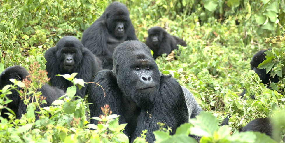
Rwanda has emerged as a global leader in wildlife conservation, demonstrating that innovation, science, and community engagement can combine to protect endangered species effectively. Nowhere is this more evident than in Volcanoes National Park, home to the iconic mountain gorillas of the Virunga Massif. These primates survive in a fragile, high-altitude ecosystem where limited habitat, human pressures, and environmental uncertainty require continuous monitoring and intervention. Traditional conservation strategies—patrols, observation, and hands-on management—remain critical, but Rwanda has increasingly embraced modern technology to strengthen these efforts, creating a system that is both proactive and adaptive.
The integration of drones, GPS tracking, digital data platforms, and advanced monitoring software allows rangers and researchers to oversee the park with unparalleled precision. Surveillance has become more efficient, data collection more accurate, and decision-making more evidence-based. By combining traditional field expertise with technological tools, Rwanda has enhanced both the safety of park personnel and the well-being of mountain gorilla populations. Beyond protecting the gorillas themselves, this approach provides a model for other high-conservation-value ecosystems facing human encroachment and climate pressures. For visitors, technology-backed conservation ensures safer, more reliable trekking experiences and reinforces the link between responsible tourism and species survival. In this article, we explore the key technologies transforming conservation in Rwanda, illustrating how innovation directly supports one of the planet’s most remarkable wildlife populations.
The Evolution from Traditional to Tech-Enabled Protection
Conservation in Rwanda initially relied on boots-on-the-ground patrols, manual record-keeping, and ranger expertise in visual tracking. Rangers memorized forest layouts, tracked gorilla families by sight, and reported activities via radio or notebook logs. While effective, this approach demanded extensive manpower, left room for human error, and sometimes delayed responses to illegal activity or ecological threats. Monitoring large, rugged terrain under these conditions was challenging, particularly as gorilla populations expanded and surrounding human pressures intensified.
The transition to technology-enabled conservation has transformed these operations without diminishing the importance of ranger expertise. GPS devices, drones, and digital data collection systems now augment human capacity. Field observations, once manually recorded, feed into centralized databases that allow park managers to identify trends, predict risks, and optimize patrol routes. Patrol coverage can be analyzed systematically, rather than relying on memory or anecdotal reports, enabling more strategic deployment of personnel.
Despite this shift, human judgment remains essential. Technology serves as a tool for informed decision-making, not a replacement for ecological knowledge. Rangers interpret digital insights in real-time, adapting strategies to shifting environmental or social conditions. This blend of traditional skill and modern innovation ensures the park can respond rapidly to threats while maintaining ethical and effective protection for mountain gorillas, making conservation smarter, faster, and more sustainable.
Drone Surveillance and Aerial Monitoring
Drones have revolutionized surveillance in Volcanoes National Park, particularly in areas that are difficult to access on foot. Equipped with high-resolution cameras, these unmanned aerial vehicles provide rapid, comprehensive coverage of park boundaries, forest edges, and sensitive gorilla habitats. This aerial perspective enables rangers to detect potential threats—such as encroachment, illegal logging, or land degradation—before they escalate into major conservation challenges.
The use of drones enhances both efficiency and precision. For example, aerial imagery allows teams to assess vegetation patterns, monitor terrain conditions after heavy rainfall, and detect early signs of erosion or habitat disruption. Drones also reduce risks for rangers by minimizing the need for constant physical presence in potentially dangerous or inaccessible areas. Importantly, drone deployment is carefully regulated to avoid disturbing gorilla families, ensuring that the technology supports protection rather than creating additional stress.
Beyond enforcement, drones provide valuable data for ecological research. Detailed aerial surveys contribute to understanding forest health, seasonal vegetation changes, and habitat connectivity. For conservation managers, these insights inform restoration projects, such as reforestation and erosion control. Visitors benefit indirectly as well; by improving surveillance and habitat management, drones help maintain stable gorilla populations and reliable trekking experiences, demonstrating the powerful role of technology in modern wildlife conservation.

GPS Tracking for Ranger Patrol Optimization
GPS technology has fundamentally changed how ranger patrols operate within Volcanoes National Park. Each patrol team carries GPS-enabled devices that continuously record movement routes, observation points, and patrol durations. This real-time mapping allows park authorities to analyze coverage patterns, identify gaps, and strategically allocate personnel to areas requiring additional attention.
Accurate navigation in dense, high-altitude forests is critical not only for effective conservation but also for ranger safety. GPS devices provide precise coordinates during emergencies and ensure that patrol teams remain aware of their location relative to gorilla habitats or challenging terrain. In addition, digitally recorded patrol data can be aggregated over time to assess operational efficiency, optimize patrol schedules, and minimize redundant coverage.
Beyond operational benefits, GPS tracking strengthens accountability and transparency. Conservation managers can demonstrate that patrols occur as planned, enhancing confidence among funders, researchers, and the public. For visitors, this technology indirectly improves trekking reliability. Efficient patrol coverage ensures gorilla families remain monitored and protected, reducing the likelihood of poaching or habitat disturbances. By combining strategic data analysis with traditional field expertise, GPS tracking exemplifies how technology supports both wildlife protection and human safety in Rwanda’s high-altitude ecosystems.
Digital Data Collection and Real-Time Monitoring
Digital data collection has transformed how field observations are recorded, shared, and utilized in Volcanoes National Park. Rangers and researchers now input information on gorilla locations, health assessments, habitat conditions, and anti-poaching activities directly into handheld devices. This information is uploaded to centralized platforms in real-time, allowing park managers to respond quickly to emerging threats or ecological changes.
Real-time monitoring ensures that veterinary teams can intervene promptly if a gorilla shows signs of illness or injury. Patrol strategies can be adjusted immediately if illegal activity is detected in a particular area. Long-term data accumulation allows for trend analysis, helping managers identify shifts in vegetation, population growth, or enforcement effectiveness. By replacing fragmented paper records with structured digital databases, conservation becomes proactive rather than reactive.
Visitors indirectly benefit from this system, as digital monitoring increases the likelihood of safe, predictable gorilla encounters. The ability to respond rapidly to threats helps maintain the integrity of trekking trails, habitat quality, and gorilla behavior. Digital platforms also facilitate collaboration between rangers, researchers, and conservation authorities, ensuring that data-driven decisions support the long-term survival of mountain gorillas while enhancing the quality of visitor experiences.
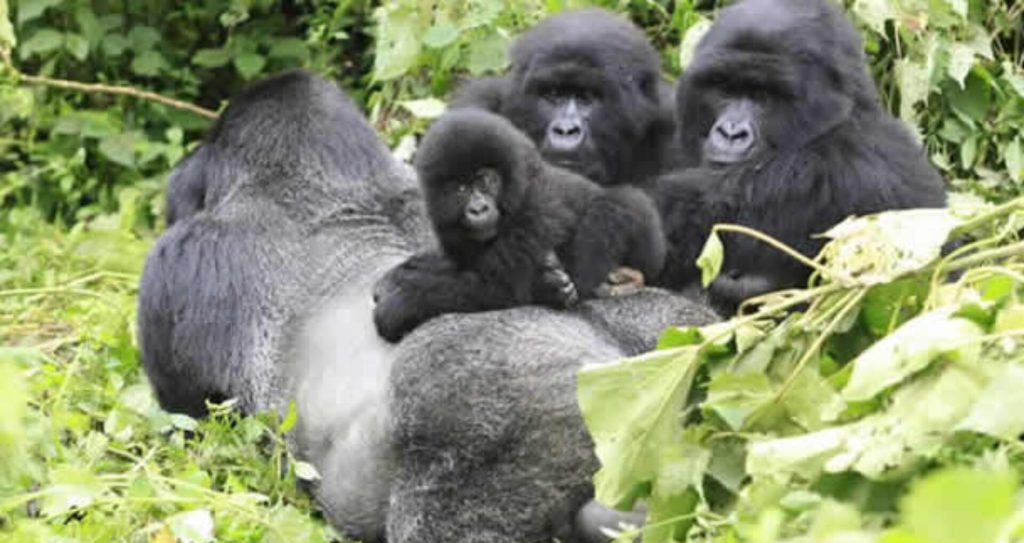
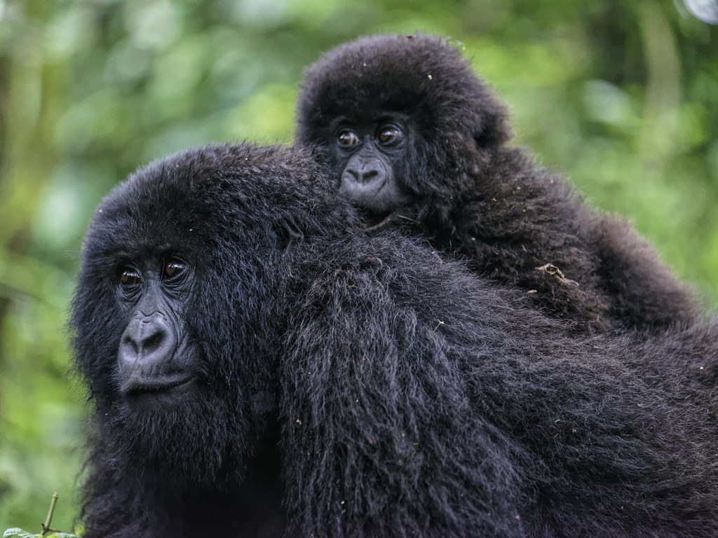
Gorilla Health Monitoring and Biometric Data
Mountain gorilla health monitoring has been revolutionized by the integration of technology into veterinary and research practices. Digital records now capture detailed health metrics for habituated families, including reproductive trends, injury reports, and demographic data. This information enables conservationists to detect subtle population shifts, identify emerging health risks, and implement preventative interventions.
Biometric and genetic data contribute to understanding family lineages, population diversity, and reproductive success. While invasive tracking devices are not used, careful observation combined with digital data management ensures accurate records of individual gorillas. Veterinary teams can plan targeted interventions based on precise location data, reducing response times and enhancing survival outcomes.
The use of technology in health monitoring strengthens conservation by linking ecological management with individual welfare. For visitors, this ensures that trekking encounters involve healthy, stable gorilla families, making experiences safer and more meaningful. Integrating technology with traditional veterinary practice demonstrates that innovation and ethical care can coexist, supporting the long-term stability of one of the world’s most endangered species.
Cross-Border Data Collaboration in the Virunga Ecosystem
Mountain gorillas inhabit the Virunga Massif, a trans boundary ecosystem spanning Rwanda, Uganda, and the Democratic Republic of Congo. Their movements across borders create unique conservation challenges that require coordinated monitoring and data sharing. Technology plays a pivotal role in enabling cross-border collaboration.
Digital platforms standardize data collection and allow secure sharing among conservation authorities. Coordinated census efforts rely on synchronized reporting and mapping, ensuring accurate assessments of population distribution and movement patterns. By pooling information, managers can identify migration corridors, detect threats across national boundaries, and implement regionally aligned strategies to prevent poaching or habitat fragmentation.
Visitors indirectly benefit from this collaboration, as consistent cross-border monitoring maintains stable gorilla populations and reliable trekking experiences. The system highlights how technology facilitates international cooperation, demonstrating that protecting highly mobile wildlife species requires both innovation and diplomatic coordination. By linking data across borders, Rwanda ensures that conservation strategies are comprehensive, proactive, and sustainable.
Technology Supporting Climate and Habitat Monitoring
Climate variability poses a growing threat to high-altitude ecosystems such as Volcanoes National Park. Changes in rainfall patterns, vegetation composition, and soil stability can directly impact gorilla survival. Digital monitoring tools allow conservationists to track these environmental factors in real-time, providing critical insights into ecosystem health.
Satellite imagery, GIS mapping, and sensor data help managers assess forest cover, detect erosion-prone areas, and plan restoration projects such as reforestation. By integrating ecological monitoring with enforcement and patrol systems, conservation teams can anticipate environmental risks, respond proactively, and ensure that habitat quality supports both wildlife and tourism.
For visitors, this monitoring ensures that trekking routes remain safe, accessible, and environmentally sustainable. Technology allows conservation teams to maintain the delicate balance between human access and ecological protection, demonstrating that innovative tools can strengthen habitat resilience alongside species protection.
Balancing Innovation with Ethical Conservation
While technological tools enhance conservation effectiveness, Rwanda emphasizes ethical standards in their application. Drone deployment is carefully managed to avoid disturbing gorilla families. Digital platforms prioritize data security and privacy. Most importantly, human expertise remains central to decision-making.
Technology functions as a support system, amplifying ranger capacity without replacing ecological judgment. Field professionals interpret digital insights within the broader context of behavior, environmental patterns, and social dynamics. This ensures that technology enhances wildlife protection rather than undermining it. Ethical integration maintains trust with local communities, safeguards animal welfare, and reinforces the integrity of conservation strategies.
Visitors can witness these efforts indirectly, experiencing trekking opportunities that are informed by both cutting-edge technology and human stewardship. The combination of innovation and ethics exemplifies Rwanda’s holistic approach to conservation, where human, animal, and ecological well-being are balanced.
Future Prospects for Conservation Technology
Rwanda continues to expand its use of technology in wildlife protection. Advanced data analytics, remote sensing, improved communication networks, and predictive modeling may further enhance conservation precision. Future tools will likely strengthen anti-poaching measures, habitat management, and ecological research.
Despite these innovations, the core goal remains the same: protecting mountain gorillas while maintaining ecosystem balance and community collaboration. Technology provides powerful tools, but sustained commitment, funding, and skilled human intervention ensure long-term success. For visitors, the integration of new technologies promises more reliable and responsible trekking experiences.
By embracing innovation thoughtfully, Rwanda sets an example for high-value conservation areas worldwide, demonstrating that modern tools can complement traditional fieldwork to protect endangered species and preserve ecological integrity.

Final Reflections
Conservation technology has transformed how Volcanoes National Park protects its endangered mountain gorillas. Drones improve surveillance, GPS tracking optimizes patrols, and digital data collection enhances decision-making. Combined with veterinary monitoring, cross-border collaboration, and climate monitoring, these innovations strengthen both wildlife protection and visitor experiences.
Rwanda’s model demonstrates that technology, when applied ethically and strategically, can amplify human expertise, safeguard fragile ecosystems, and maintain sustainable wildlife tourism. Visitors who support these initiatives contribute directly to a conservation system that is modern, evidence-based, and responsible.
Experience Responsible Conservation with Us
Volcanoes National Park organizes professionally managed gorilla trekking experiences where innovation supports every visitor encounter. Each permit contributes directly to ranger operations, veterinary monitoring, and technological advancement in conservation. By following park guidelines and engaging responsibly, visitors become part of a broader effort to protect mountain gorillas while enjoying a once-in-a-lifetime experience.
Leave A Comment